


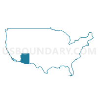
Gila, Graham, Greenlee & Pinal (East) Counties PUMA, Arizona
About
Outline
+Counties+PUMA%2c+Arizona_A280.png)
Summary
| Unique Area Identifier | 192168 |
| Name | Gila, Graham, Greenlee & Pinal (East) Counties PUMA |
| State | Arizona |
| Area (square miles) | 12,317.14 |
| Land Area (square miles) | 12,250.61 |
| Water Area (square miles) | 66.53 |
| % of Land Area | 99.46 |
| % of Water Area | 0.54 |
| Latitude of the Internal Point | 33.30318920 |
| Longtitude of the Internal Point | -110.23132440 |
Maps
+Counties+PUMA in Arizona.png)
Graphs
Select a template below for downloading or customizing gragh for Gila, Graham, Greenlee & Pinal (East) Counties PUMA, Arizona
+Counties+PUMA%2c+Arizona_T0.png)
+Counties+PUMA%2c+Arizona_T1.png)
+Counties+PUMA%2c+Arizona_T2.png)
+Counties+PUMA%2c+Arizona_T3.png)
+Counties+PUMA%2c+Arizona_T4.png)
+Counties+PUMA%2c+Arizona_T5.png)
+Counties+PUMA%2c+Arizona_T6.png)
+Counties+PUMA%2c+Arizona_T7.png)
+Counties+PUMA%2c+Arizona.png)
Neighbors
Neighoring Public Use Microdata Area (by Name) Neighboring Public Use Microdata Area on the Map
- Cochise & Santa Cruz Counties--Sierra Vista City PUMA, AZ
- Coconino County--Flagstaff City PUMA, AZ
- Maricopa County (Northeast)--Scottsdale City (Southeast) & Fountain Hills Town PUMA, AZ
- Navajo & Apache Counties PUMA, AZ
- Pima County (Northeast) PUMA, AZ
- Pinal County (Central)--Florence Town, Eloy (Northeast) & Coolidge Cities PUMA, AZ
- Pinal County (North)--Apache Junction City PUMA, AZ
- Southwest New Mexico PUMA, NM
- Yavapai County PUMA, AZ
Top 10 Neighboring County (by Population) Neighboring County on the Map
- Maricopa County, AZ (3,817,117)
- Pima County, AZ (980,263)
- Pinal County, AZ (375,770)
- Yavapai County, AZ (211,033)
- Coconino County, AZ (134,421)
- Cochise County, AZ (131,346)
- Navajo County, AZ (107,449)
- Apache County, AZ (71,518)
- Gila County, AZ (53,597)
- Graham County, AZ (37,220)
Top 10 Neighboring County Subdivision (by Population) Neighboring County Subdivision on the Map
- Tucson CCD, Pima County, AZ (853,603)
- North Pinal CCD, Pinal County, AZ (152,330)
- Flagstaff CCD, Coconino County, AZ (89,754)
- Camp Verde-Sedona CCD, Yavapai County, AZ (36,611)
- Florence CCD, Pinal County, AZ (34,685)
- Safford CCD, Graham County, AZ (24,993)
- Payson CCD, Gila County, AZ (23,807)
- San Manuel CCD, Pinal County, AZ (20,418)
- Globe-Miami CCD, Gila County, AZ (18,134)
- Benson CCD, Cochise County, AZ (12,520)
Top 10 Neighboring Place (by Population) Neighboring Place on the Map
- Florence town, AZ (25,536)
- Payson town, AZ (15,301)
- Safford city, AZ (9,566)
- Globe city, AZ (7,532)
- Thatcher town, AZ (4,865)
- San Carlos CDP, AZ (4,038)
- San Manuel CDP, AZ (3,551)
- Clifton town, AZ (3,311)
- Swift Trail Junction CDP, AZ (2,935)
- Superior town, AZ (2,837)
Top 10 Neighboring Elementary School District (by Population) Neighboring Elementary School District on the Map
- Oracle Elementary District, AZ (13,622)
- Pine Strawberry Elementary District, AZ (2,952)
- Solomon Elementary District, AZ (2,883)
- Tonto Basin Elementary District, AZ (1,634)
- Bonita Elementary District, AZ (1,197)
- Young Elementary School District, AZ (885)
- Chevelon Butte School District, AZ (650)
- Alpine Elementary District, AZ (463)
- Redington Elementary District, AZ (96)
- Klondyke Elementary District, AZ (66)
Top 10 Neighboring Unified School District (by Population) Neighboring Unified School District on the Map
- Flagstaff Unified District, AZ (91,658)
- Florence Unified School District, AZ (70,940)
- School District Not Defined, AZ (69,809)
- Payson Unified District, AZ (21,636)
- Silver City Consolidated Schools, NM (21,377)
- Safford Unified District, AZ (16,677)
- Camp Verde Unified District, AZ (11,452)
- Whiteriver Unified District, AZ (11,176)
- Globe Unified District, AZ (10,636)
- Willcox Unified District, AZ (8,533)
Top 10 Neighboring State Legislative District Lower Chamber (by Population) Neighboring State Legislative District Lower Chamber on the Map
- State House District 23, AZ (370,479)
- State House District 4, AZ (294,239)
- State House District 30, AZ (231,236)
- State House District 1, AZ (217,022)
- State House District 25, AZ (208,220)
- State House District 26, AZ (195,881)
- State House District 5, AZ (192,258)
- State House District 49, NM (31,024)
- State House District 38, NM (23,451)
- State House District 39, NM (22,945)
Top 10 Neighboring State Legislative District Upper Chamber (by Population) Neighboring State Legislative District Upper Chamber on the Map
- State Senate District 23, AZ (370,479)
- State Senate District 4, AZ (294,239)
- State Senate District 30, AZ (231,236)
- State Senate District 1, AZ (217,022)
- State Senate District 25, AZ (208,220)
- State Senate District 26, AZ (195,881)
- State Senate District 5, AZ (192,258)
- State Senate District 28, NM (43,562)
- State Senate District 35, NM (39,691)
Top 10 Neighboring 111th Congressional District (by Population) Neighboring 111th Congressional District on the Map
- Congressional District 6, AZ (971,733)
- Congressional District 1, AZ (774,310)
- Congressional District 8, AZ (754,300)
- Congressional District 2, NM (663,956)
- Congressional District 5, AZ (656,833)
Top 10 Neighboring Census Tract (by Population) Neighboring Census Tract on the Map
- Census Tract 8.03, Pinal County, AZ (12,149)
- Census Tract 2.07, Pinal County, AZ (11,032)
- Census Tract 8.01, Pinal County, AZ (8,774)
- Census Tract 9.01, Pinal County, AZ (7,281)
- Census Tract 15, Yavapai County, AZ (6,550)
- Census Tract 3.01, Gila County, AZ (5,810)
- Census Tract 2.01, Pinal County, AZ (5,469)
- Census Tract 5, Gila County, AZ (5,429)
- Census Tract 9404, Gila County, AZ (5,288)
- Census Tract 22, Pinal County, AZ (5,250)
Top 10 Neighboring 5-Digit ZIP Code Tabulation Area (by Population) Neighboring 5-Digit ZIP Code Tabulation Area on the Map
- 85132, AZ (33,556)
- 85541, AZ (21,877)
- 85546, AZ (19,677)
- 85501, AZ (13,345)
- 85118, AZ (12,246)
- 86322, AZ (11,480)
- 85941, AZ (9,941)
- 85643, AZ (9,810)
- 85602, AZ (9,464)
- 85552, AZ (6,218)